By Melissa Young, Web Producer, Office of Web Services

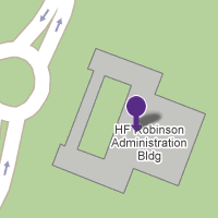
Web Services is bringing Google Maps technology to the WCU campus map later this spring.
At launch, each building and parking lot on campus will be identified on the new Web-based map. Visitors will be able to click on a building to learn its name, see its photo and link to the Web pages of the resident offices or departments.
Wondering where to find the commuter parking? Residential living buildings? Academic buildings? See all options with just one click.
Web Services plans on adding more features and customizations over the course of the summer. Possibilities include locations of emergency phones, CAT-TRAN stops, PAW Print release stations, computer labs and walking trails.
What else would you like to see on the online campus map? Send your ideas and questions to Melissa Young in the Office of Web Services at myoung@wcu.edu or (828) 227-2445.
